GNSS satellite positioning is present in everyone’s daily life. With a wide variety of application areas, its functioning is often little known. How does it work? From theory to practice, the fundamental principles of GNSS positioning
We owe the Global Positioning System (GPS) to the American military. Starting in 1973, it created the first satellite positioning technology. Originally reserved for strictly military use, GPS was freely opened for civilian applications in the year 2000. Over the years, it has become an essential part of society.
And although common language often uses the term “GPS” to refer to this technology, it is more accurate today to talk about the Global Navigation Satellite System (GNSS). Indeed, other constellations and positioning systems have joined the American GPS.
Today, we have thousands of satellites around the Earth. Among them are the satellites from the American GPS constellation, the Russian GLONASS, the European GALILEO, and the Chinese BEIDOU… Not all are yet fully operational. This is the case for GALILEO and BEIDOU, which should be by 2020.
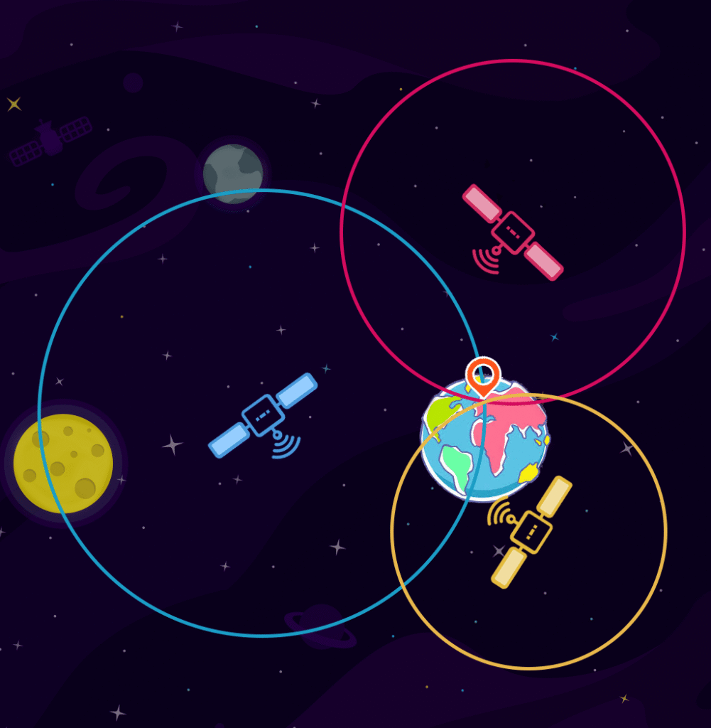
The principle of operation is based on the intersection of electromagnetic signals emitted by satellites. The user detects satellite signals defining user segments of satellites whose geometric intersection allows for localization.
In order to be continuously functional everywhere and at all times, current solutions use signals from multiple constellations. This overlap of information allows for better accuracy, near-instantaneous convergence times, and 24/7 availability worldwide.
The accuracy of receivers is at best metric. Various calculations and strategies are used to improve this accuracy. TERIA is one of the tools to enhance precision. It allows the user to achieve centimeter-level accuracy in real-time.
The arrival of new centimeter-level solutions enables us to tackle new application areas: autonomous vehicle guidance, marine uses, drones, etc.

The nominal operational constellations GPS, GALILEO, GLONASS, BEIDOU… consist of several dozen satellites operating at an altitude of nearly 20,000 km along orbits evenly distributed to cover all continents.
Thanks to this coverage, the user is able to see simultaneously between five and thirty-five satellites depending on their position on Earth.
Each constellation is monitored and controlled by control stations that update the information (positions, ephemerides, and clock corrections) of all satellites. They then spread their parameters to the Earth via electromagnetic waves carrying coded signals.
The GPS, GALILEO, GLONASS, BEIDOU satellites… have atomic clocks that provide extremely precise timing. The time information is placed in the codes broadcast by the satellite. The receiver then continuously determines the time at which the signal was broadcast. The signal also contains orbital data so that the receiver can calculate the location of the satellites. This is what is called navigation information.
The GNSS receiver (phone, surveying, agriculture, automotive/aeronautical guidance system…) uses the time difference between the reception and the broadcast time of the signal to determine the distance between the receiver and the satellite. The receiver multiplies the travel time by the speed of light to calculate the receiver/satellite distance.
Thus, a mobile GNSS that captures signals from at least four satellites can accurately locate any point within the visibility of the satellites in three dimensions. To do this, it will use the intersection of these satellite-receiver vectors.
However, even in the absence of obstacles, significant disturbing factors require correction of the calculation results. The first is the crossing of the lower layers of the atmosphere, the troposphere. The presence of moisture and changes in pressure in the troposphere alter the refractive index and thus the speed and direction of propagation of the satellite signal.
The second disturbing factor is the ionosphere. This layer ionized by solar radiation changes the speed of signal propagation. Most receivers integrate a correction algorithm.
The third and final step is to determine an accurate position. The receiver will be able to perform a trilateration of the position from the distance data collected between the receiver and several satellites.
A GNSS receiver needs at least 4 satellites to calculate its own position. Three satellites will determine latitude, longitude, and height, while the fourth allows for synchronization of the receiver’s internal clock.
To popularize the demonstration, we will place ourselves on a 2D plane. The principle will be identical when moving to 3D space. Only the circles will be replaced by spheres.
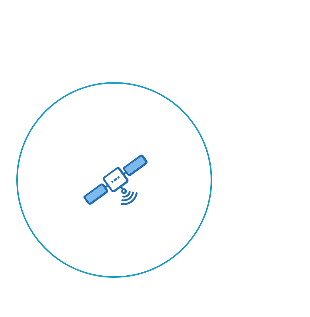
Suppose the receiver is 25,000 km from a given first satellite. This means that the receiver can be located anywhere on the 25,000 km diameter circle, with the satellite as the center.
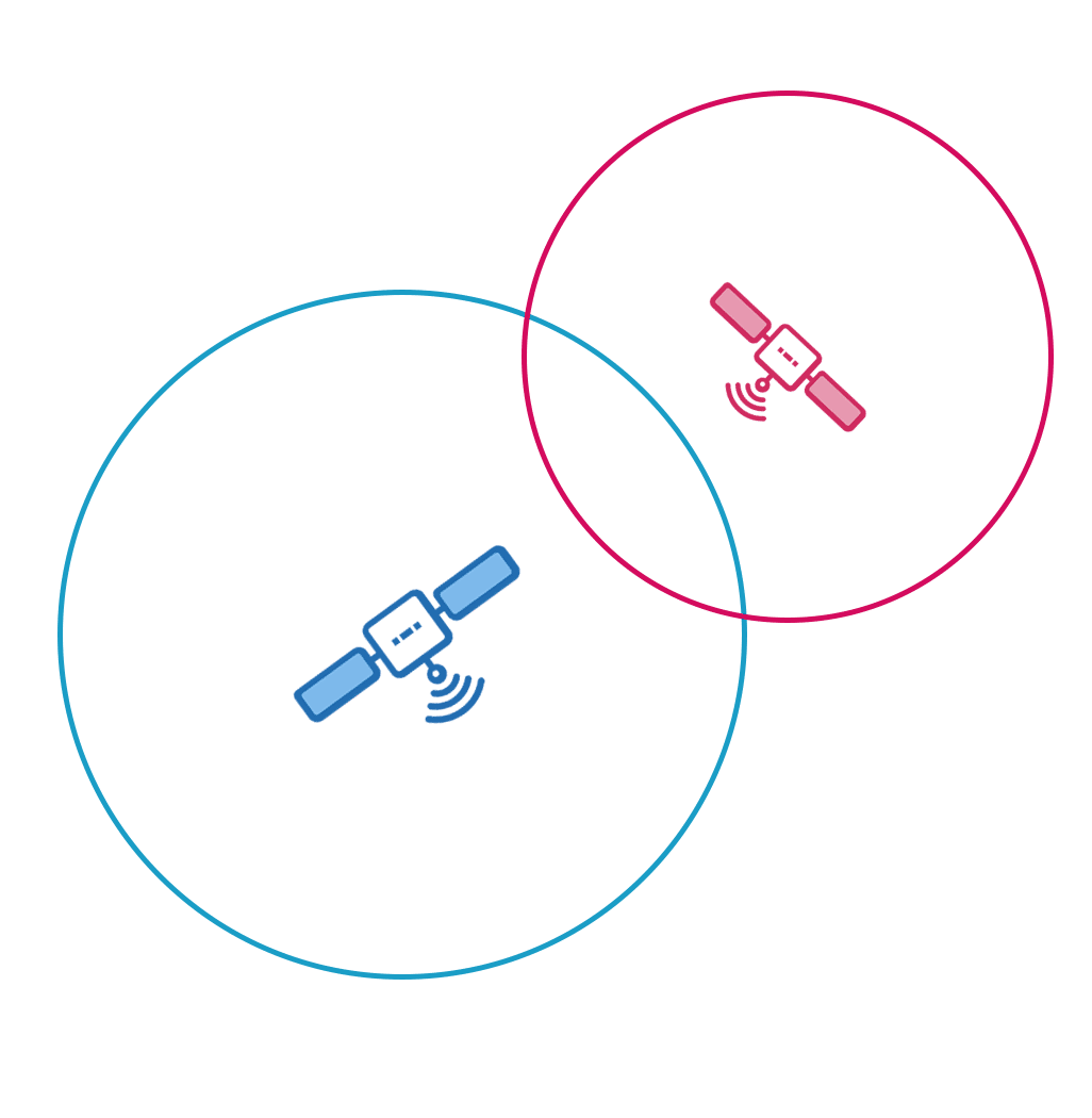
The box will also receive a signal from a second satellite at 20,000 km, for example. It will conclude that it is also on this circle. Its exact position will be at the intersection of the two circles, meaning two possibilities.
To determine which of these possibilities is correct, the signal from a third satellite is necessary. For the demonstration, we will imagine it with a diameter of 15,000 km.
At the intersection of these three circles, there remains only one possible point in a 2D plane. We have just geolocated our receiver.
Swipe to move from 2D to 3D
To move to 3D, a 4th satellite would thus be necessary, as the intersection of 3 spheres gives 2 points. However, we can do without it because only one of the two points is geometrically consistent. And thus there would still be one possibility to eliminate.
However, the use of a 4th satellite is necessary, as it provides solutions based on the signal propagation time. Ground GNSS receivers only have coarse clocks that do not have the precision of satellite atomic clocks. The result is a desynchronization that must be resolved in order to control the receiver-satellite distance and then obtain correct geolocation.
Follow us on social media and via our Newsletter!




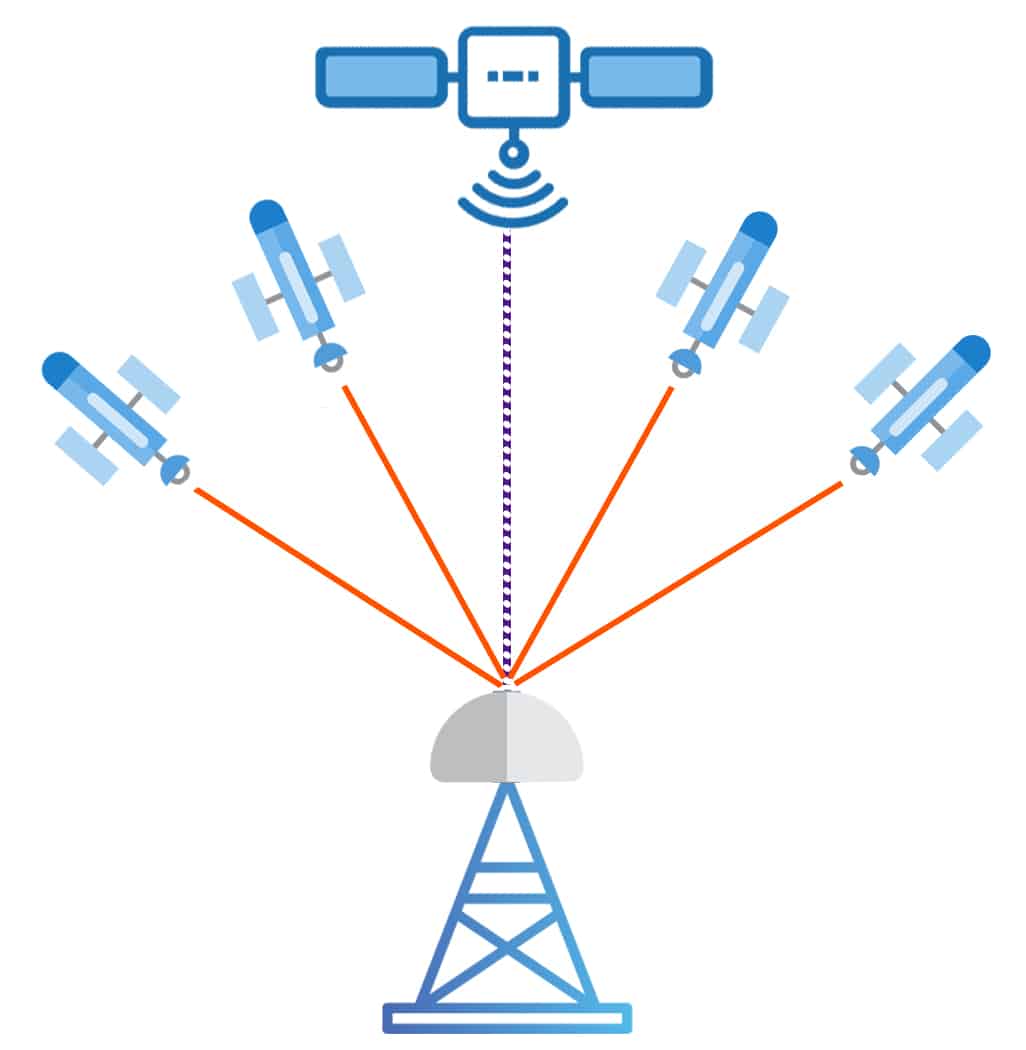
The example refers to the use of four satellites, but GNSS receivers are capable of tracking many satellites at once (stations, surveying, phone, navigation device…). This improves accuracy, convergence time, coverage, and reduces the risk of errors.
On average, a receiver can capture 7 satellites from the same constellation (14 satellites on GPS — GALILEO). For centimeter-level positioning, at least 5 satellites are essential.
Currently, 129 positioning satellites are active and available for civilian applications:
For applications where centimeter-level precision is essential (autonomous vehicle, bathymetry, surveying…), this is not enough. Indeed, distortions in signal propagation can lead to errors of several meters. This is particularly the case in the crossing of atmospheric layers.
Some solutions such as TERIA can correct these measurement errors and provide centimeter-level positioning of 1-2cm in real-time.
They rely on networks of receivers all connected to computing centers, which model all errors and corrections back (PPP, PPP-RTK, NRTK, and RTK) in real-time to users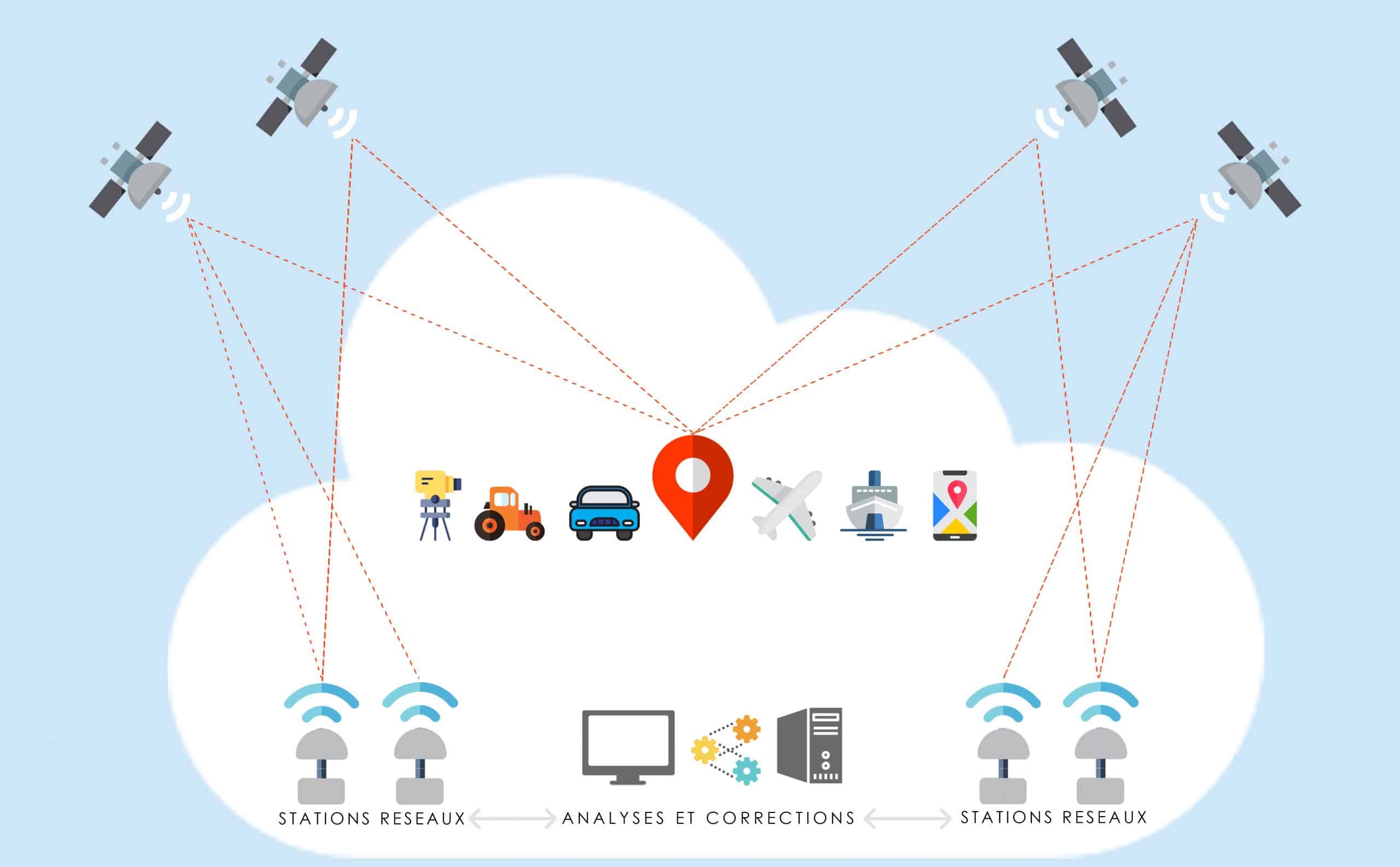
To mathematically locate an object on Earth unambiguously, it is necessary to define a geodetic deposit that is expressed by geographic coordinates which are most often: latitude, longitude, and altitude (or elevation) relative to mean sea level (orthometric height) or relative to a reference surface, usually ellipsoidal (ellipsoidal height).
Historically, geodetic systems were determined from angular measurements and length measurements. A geodetic system was associated with a geodetic network, a set of points whose coordinates had been determined from terrestrial measurements.
Space technology has allowed for the definition of global geodetic systems. The most widely used geodetic system in the world is the World Geodetic System 1984 (WGS84), associated with the American GPS positioning system.
Source: color-science.eu gnssplanning.com Do you want to try TERIA for your business?
Tag: update a GPS